Cycle Llanidloes
View the Llanidloes Cycle routes
Hafren Forest and Llyn Clywedog
A beautiful 18 mile circular ride from Llanidloes which takes you to the Upper Severn Valley, through the Hafren Forest and alongside the large reservoir, Llyn Clywedog. There are recommended diversions to Severn Break-its-Neck waterfall, the Afon Biga picnic area and nature trail, the viewing area above the dam at Clywedog and the abandoned mine buildings at Bryntail. The cycle ride ends with a cyclists dream road, a tiny minor road which descends through natural woodland to Llanidloes. Cyclable in 2 hours but allow more time to explore the forest, waterfall, lake, dam and the old mines.
|
Start |
Llanidloes Market Hall |
|
Total distance |
18 miles (29 km) |
|
Rating |
Moderate |
|
Riding description |
Gentle but long climb, gently undulating thereafter but two steep climbs near the lake. Mostly single track traffic-free road all the way. |
|
Facilities |
Food and drink at Llanidloes, toilet facilities at Rhyd-y-Benwch car-park and picnic area (not in winter), refreshments at Red Kite Kiosk, Llyn Clywedog |
Map directions
We recommend you consult Ordnance Survey Map (OS-214) or view this gps.com map
Route Description
0.0 miles Start at the Market Hall in Llanidloes and cycle down Shortbridge Street towards the river. Shortbridge Street is signed as Hafren Forest from the black and white market hall
 0.1 miles Cross the River Severn on the Shortbridge and bear left to start the ascent to the Upper Severn Valley
1.6 miles Cycle through the small hamlet of Glan-y-Nant
2.7 miles The road bears right sign-posted to Hafren, Old Hall and Staylittle
3.0 miles Cycle through the small hamlet of Old Hall
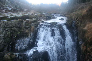 6.5 miles Track to the left is sign-posted Severn Way. About 50 metres down on the left, you can divert to see Severn Break-its-Neck Waterfall before returning to the road to continue the ride
6.7 miles Rhyd-y-Benwch car-park and picnic area. This is the start of the walk to the Source of the River Severn. There are toilet facilities here except during the winter months
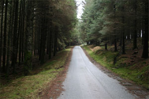 7.0 miles The road continues through dense pine forest to climb to its high point of 357m, 200m altitude above Llanidloes before reaching more open countryside
9.0 miles Turn right on road sign-posted to Clywedog Reservoir and dam
9.3 miles Afon Biga picnic area and nature trail in wooded area surrounding the Clywedog river
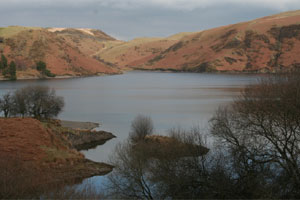 9.6 miles The road follows the edge of the large Lake Clywedog
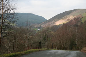
11.2 miles The road climbs steeply away from the Lake, a difficult climb but the view from the top is spectacular, all the way to the English border
13.4 miles The dam. A small road signed Viewing Area to the left gives access to a view over the dam and the Red Kite Kiosk for refreshments
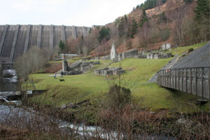 14.1 miles Road sign-posted Bryntail Mine to the left is worth a diversion. About 1/4 mile from the junction there is a car park and track to the old mine buildings at Bryntail, now over-shadowed by the huge concrete wall of the dam. Return the same way back to the main route
14.6 miles Road crosses the River Clywedog
 15.4 miles As the road starts to climb steeply, look for very minor road to the right. The road is overlooked by a red-brick house and farm. Turn right
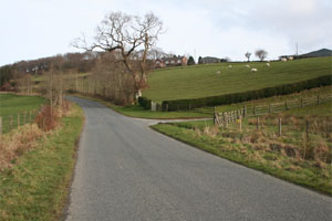
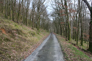 16.0 miles The minor road descends through very beautiful wooded countryside towards Llanidloes
17.1 miles Clywedog Park caravan park. Turn right when you reach the main road
18.0 miles Road descends to Llanidloes. In Llanidloes turn right and cross the river Severn on the Longbridge. At the roundabout turn right and the road leads back the Market Hall
Route Highlights