Cycle Llanidloes
View the Llanidloes Cycle routes
The Machynlleth Mountain Road
A spectacular 42 mile figure-of-eight ride from Llanidloes which takes you to the highest mountain road in the area (take care in winter as the snow can be bad!) and some great riding through mid welsh valleys.
|
Start |
Llanidloes Market Hall |
|
Total distance |
41 miles (67 km) |
|
Rating |
Moderate - Hard |
|
Riding description |
This proposed route avoids some of the worst gradients in the area but some moderately strenuous climbs, mostly rewarded by great views though. |
|
Facilities |
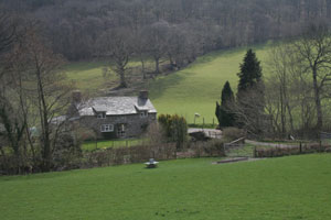
Food and drink at Llanidloes and Trefeglwys, village store at Staylittle, pub at the Star Inn beyond Staylittle, toilet facilities at Rhyd-y-Benwch car-park and picnic area (not in winter) |
Map directions
We recommend you consult Ordnance Survey Map (OS-214 and OS-215) or view this gps.com map
Route Description
0.0 miles Start at the Market Hall in Llanidloes and cycle east from the Market Hall down Longbridge Street.
0.2 miles Turn left at the roundabout and cross the River Severn on the Longbridge and then turn left on the road sign-posted to Llyn Clywedog (B4518)
 0.9 miles Take first right up steeply climbing unsigned road which quickly gives great views of Van and the Van Hill. Look out for hollow tree on left!
2.9 miles The road reaches the main Llanidloes to Trefeglwys road. Turn left on B4569.
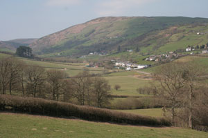
4.5 miles Enter Trefeglwys and turn left on road signed to Staylittle and Llawryglyn
 6.8 miles Enter the small hamlet of Llawryglyn and continue straight on.
7.4 miles Take first right after Llawryglyn on unsigned road and climb steeply up beautiful wooded valley
9.4 miles Take right at T-junction and descend to Staylittle (village store available)
10.3 miles Take right at Staylittle signed to Llanbrynmair and Machynlleth (B4518)
11.4 miles Turn left on Sustrans Route 8 signed to Machynlleth as narrow mountain road (perfect for cyclists but take care in bad weather - I have struggled in a blizzard on this road on a bike when weather in the valleys was fine!)
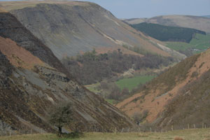 12.0 miles Admire the gorge of Afon Twymyn to the right
12.5 miles The road passes through the former lead mines, now abandoned, but still obvious in their impact on the landscape.
12.8 miles Star Inn, one of the highest pubs in the area.
14.7 miles The turn left for the Montgomeryshire Wildlife Trust reserve at Glas Llyn and the high point of the road at 509 metres
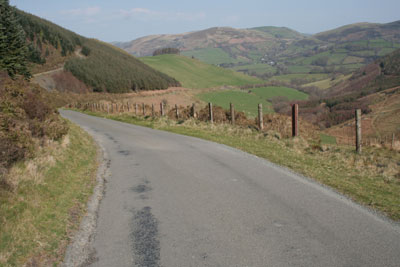
 15.2 miles Viewpoint at the Wynford Vaughan Thomas viewpoint
16.0 miles Enjoy the descent - it's one of the finest in mid Wales!
18.4 miles Turn right on road signposted to Melinbyrhedyn and Talywern and enjoy the ride through this isolated valley towards the village of Melinbyrhedyn
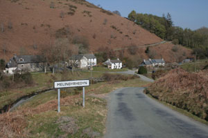 19.2 miles At village of Melinbyrhedyn, pass through and climb steeply out of village on unsigned road to Talywern
20.6 miles At the village of Talywern take right and follow signs for Bont Dolgadfan. The road cimbs a beautiful valley before dropping down the gorge.
24.7 miles Bont Dolgadfan. Turn right on B4518.
26.3 miles Village of Pennant
30.0 miles Turn right on road signed to Llwynygog and Hafren Forest
31.7 miles The road enters the Hafren Forest. The final 10 miles is mostly downhill through the forest back to Llanidloes
32.5 miles This is the turn left for the reservoir at Llyn Clywedog. Continue straight on.
35.0 miles Break-its-Neck waterfalls. Quick diversion to right on track to see the waterfall
41.5 miles Arrives back in Llanidloes
