What to do · Walk Llanidloes
Walks Library
Downloadable and printer friendly route descriptions, maps and GPX files to help you make the most out of walking in Mid Wales.
Part of Walk Llanidloes · the full library of downloadable routes.
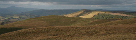
Walk LlanidloesHere you'll find downloadable and printer friendly route descriptions and maps to help you make the most out of walking in Mid Wales.
How do you use a .GPX file?
Download the .GPX file for the walk you'd like to take from this page, then open it in a GPS app or device to view the route. Many smartphones and fitness devices can do this, popular apps include:
- Google Maps: though it doesn't natively support .GPX files, you can convert .GPX to a format Google Maps understands using free online tools
- GPX Viewer (for Android and iPhone)
- Komoot (for walking and cycling routes)
- Garmin GPS devices
Once the .GPX file is loaded, the app will show you the route on a map, and as you walk it will track your position so you can easily stay on course.
Quick guide to route lengths
2.5 to 3 miles: Walk One.
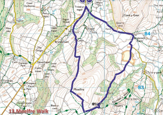
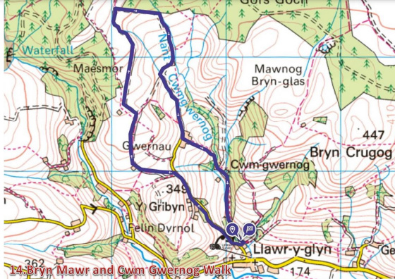
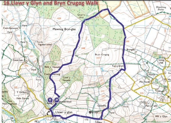
3 to 5 miles: Walk Two, Walk Thirteen, Walk Fourteen and Walk Sixteen.
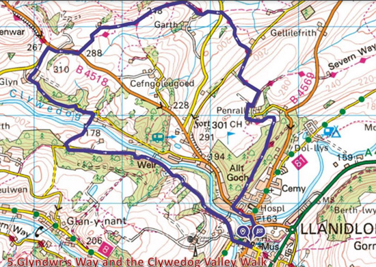
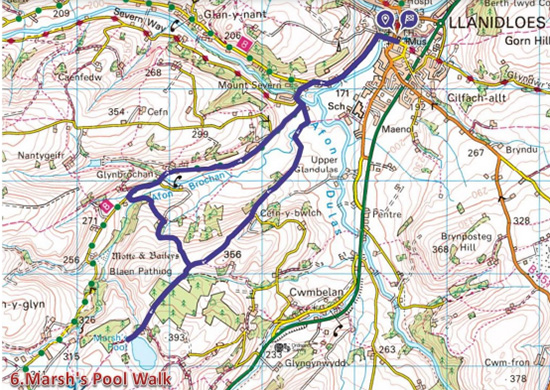
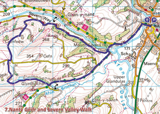
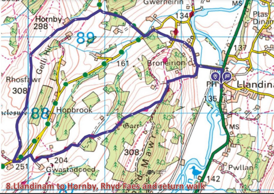
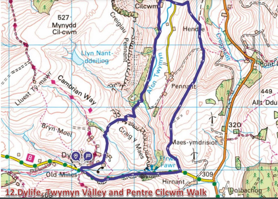
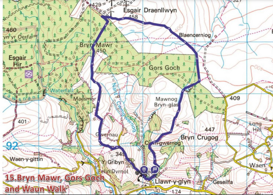
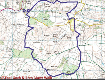
5 to 7 miles: Walk Three, Walk Five, Walk Six, Walk Seven, Walk Eight, Walk Nine, Walk Twelve, Walk Fifteen and Walk Seventeen.
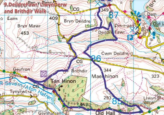
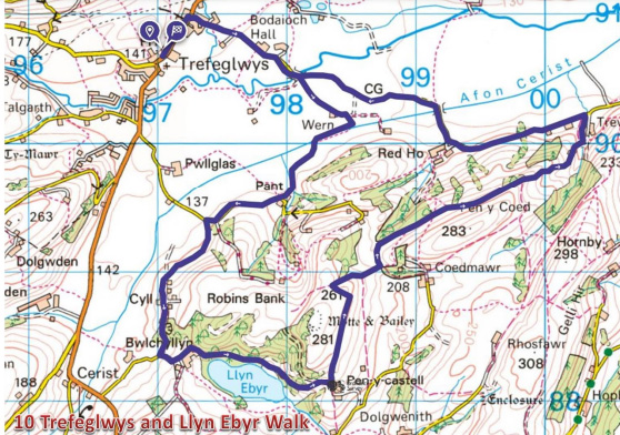
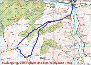
7 to 10.5 miles: Walk Ten and Walk Eleven.
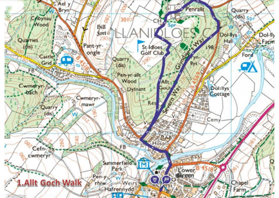
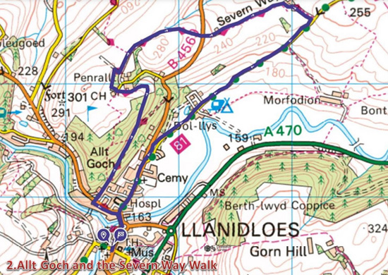
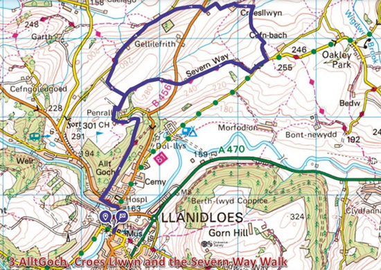
Routes
The Walks Library
If you can't view the documents above, download Adobe Reader for free (external link).
Maps
The OS maps you may need
For walks close to Llanidloes
OS Explorer Map 214, Llanidloes & Newtown Ordnance Survey
OS Landranger Map 136, Newtown & Llanidloes Ordnance Survey
For walks north of Llanidloes towards Machynlleth
OS Explorer Map 215, Newtown & Machynlleth Ordnance Survey
OS Landranger Map 135, Aberystwyth & Machynlleth Ordnance Survey
Plan your visit
Accommodation, Eat & Drink, Shops and Services in Llanidloes


Run a business or organisation in Llanidloes?
Get in touch to find out more about joining the llanidloes.com website.